
Despite a cold i had to get out and taste some mountain air on Monday. The local trails have been well trodden over recent months and i havent been out of the Postcode for some time so i decided to take a risk and run to the hills.
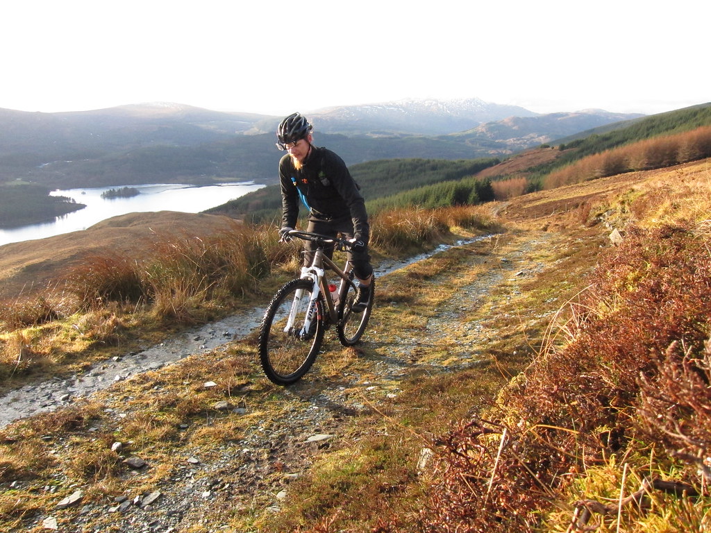
I also wanted to see if i could close a loop that on a map looked like an awesome trail. I had hit the first part sometime ago: the trail disappearing off into the distance was tantalising as i had to turn tail and head back due to fading light and a need to be elsewhere. The sun was peaking from behind the clouds: time to ride.
This time i approached from the south then gained a broad ridge and went north west. It took 2 and a half hours of grovelling with my weakened constitution to gain the needed altitude.
When it came, the drizzle was welcome as it helped wash the stench of goat from the air. As i climbed upwards, a huge mob of deer passed from the eastern, higher ground, across the trail and down. As ever, catching the fleet of foot with a pocket camera wasnt easy - just a few found their way onto the memory stick. Click to make big and you might see one or two...
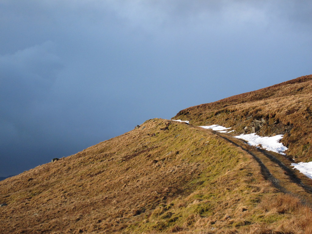
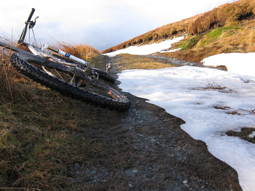
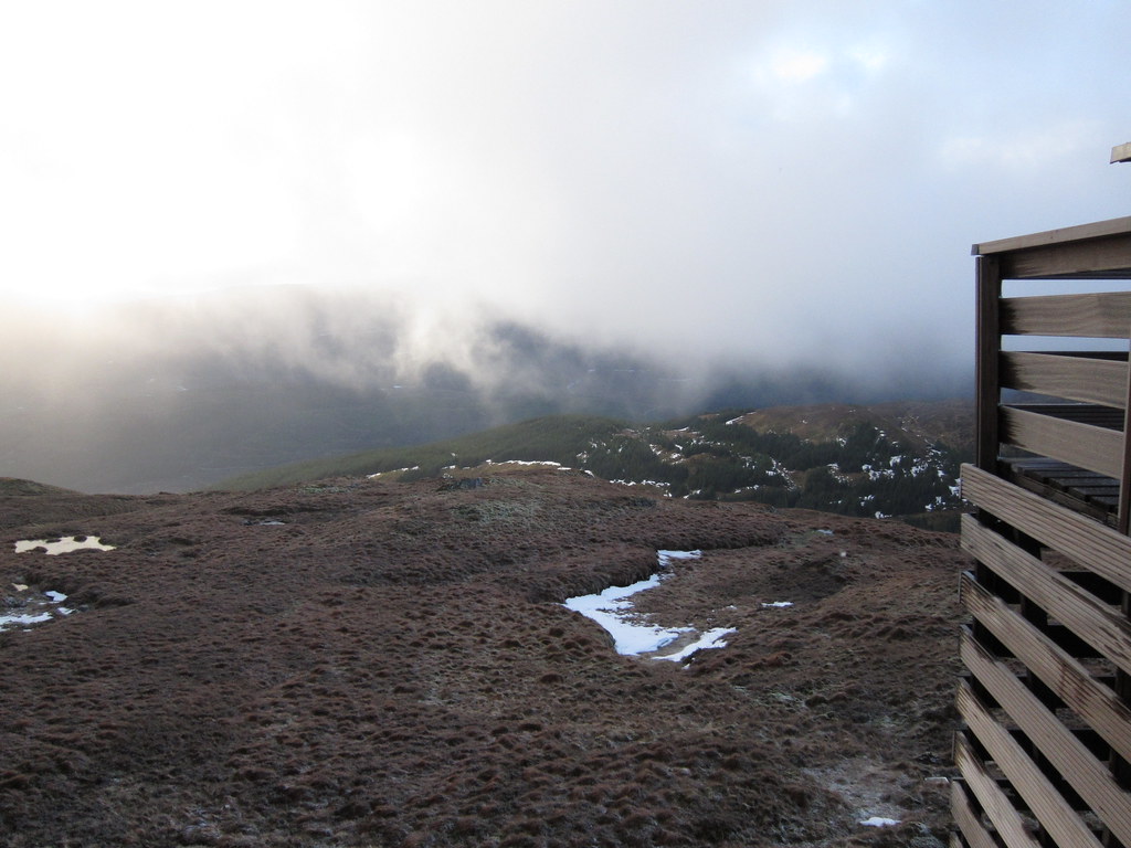
Once there i could see the dark clouds gather over Ben Lomond. No doubt there was precipitation. The ground was so waterlogged that riding was hard, but i was happy to deal with this and wasnt super insulated for snow or hail. What little ice remained was avoidable even as i got higher, and i didnt want the trail obscured by a fresh fall.
Needless to say as i reached the highest point, the winds rose and the semi-frozen snow/hail stung as it lashed the exposed areas of my skin. I was pretty surprised at my luck to see a wee house pinned to the very highest rock outcrop up there.
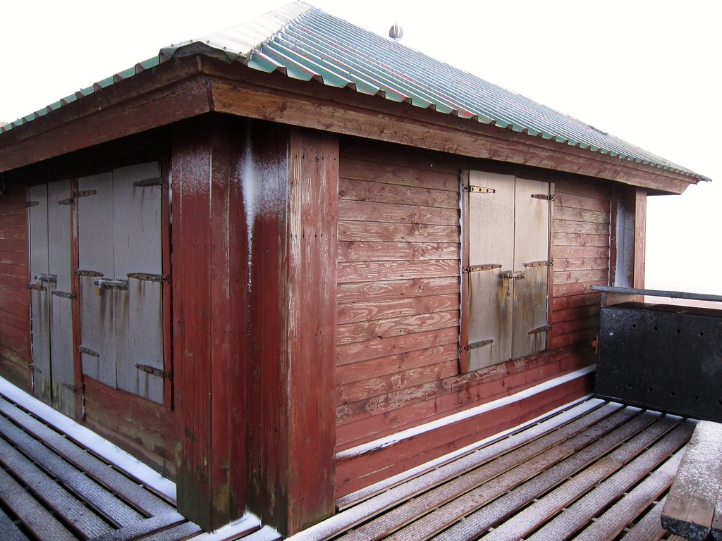
From the volume of snow on the access trail i reckoned the odds of their being anyone home were very slim, but the edge of a solid structure beat lying down in peaty cuts in the land as shelter.
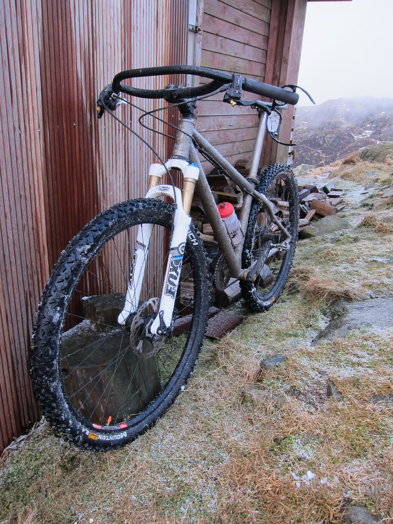
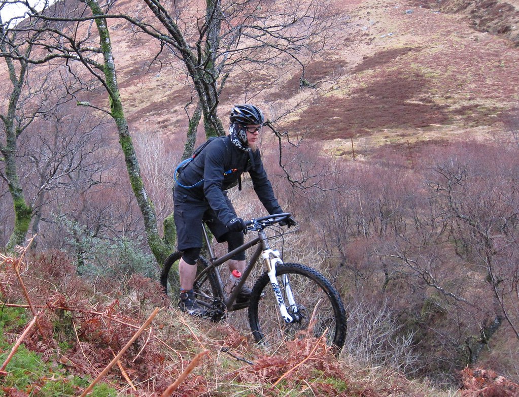
As the snow hit my frame, it instantly became ice, leading to some pretty interesting texture on the bike! After a while, cloud base lifted and visibility was regained, Circulation to the hands took a little longer to regain, but it came and i set off.
From here, the map was indistinct. There was definitely trail for some of the way, and it looked like it would come mightily close to the singletrack as it passed through the bealach from the north east. To find out was the aim for this ride.
Degraded wasnt the best word for the trail as it dropped. Broken, loose, akin to a fast moving river is more likely to give a picture, but i made it down unscratched and there, just at the bottom of the valley - the singletrack!.
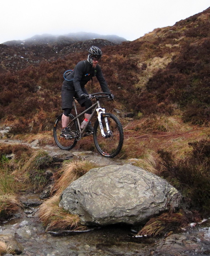
From here the trail was initially water logged with several massively over-flowing stream crossings to deal with but it dropped further into a root infested technical playground - that even now, and imagining it dry (ish) i'm not convinced i will be able to clear.
The route is complete. Now i need a day and some weather and a few hardy souls looking for about 6 hours in the hills.
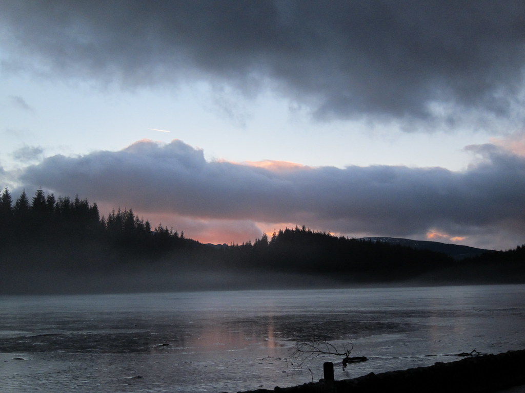
The sun set and a smile lodged on my face. A fine day!
9 comments:
Sounds like just the trail medicine that I need prescribed.
Nice report makes me wanna make the missing link on a few of my projects (shame some of the links require a packraft)
Count me in for a return mission.
Yes please.
Cracking closing shot.
Sounds sweet! Count me in for a return trip :-)
Awesome. Great last shot, dude.
Count me in as very interested for some of that action too :^)
me too :-)
Ah the classic Ben Venue route. Discovered that one a few years ago. Have you gone to the summit? Only a couple of short carry downs. Magic descent. Try Craig More above Aberfoyle next. Very nice indeed.
you seen to have half a steering wheel on your bike?
That looks interesting - you have a gps file for it? .gpx .tcx Would be good to try it if you don't mind.
rich
(richdirector@gmail.com)
sorry rich! old school frayed paper maps here :-)~
Post a Comment